-
588 pages. Mis à jour en 2025.
Disponible sur Amazon.com
en trois livres imprimés pleine grandeur et en couleur, et
un livre numérique Kindle ebook format “mise en page fixe” (print replica).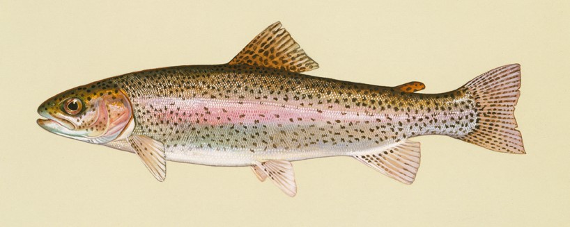
Truite arc-en-ciel. Image de Duane Raver Art – U.S. Fish & Wildlife Service.

-
WADE FLY FISHING
NORTHERN VERMONT(Ce livre n’est disponible qu’en anglais seulement. Cependant, le niveau de détail des cartes permet son utilisation par des personnes n’ayant qu’une connaissance rudimentaire de l’anglais.)
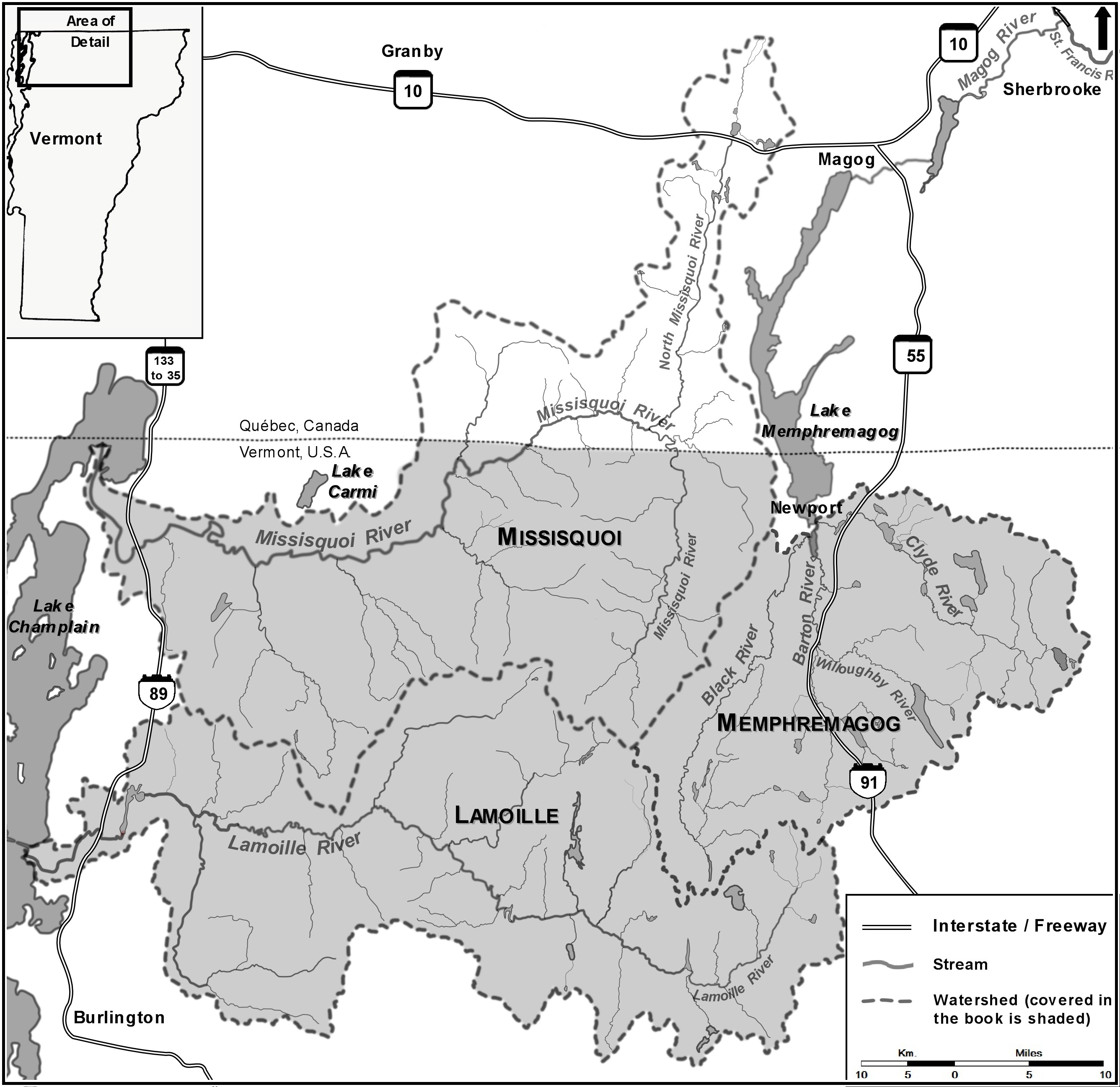
This book is a comprehensive guide to fly fishing the rivers and stream of the Lamoille, Memphremagog and Missisquoi watersheds of Northern Vermont. Crossed by the Green Mountains of the Appalachians the region covered in this book comprises the Northeast Kingdom to Lake Champlain in the beautiful region loosely described as Northern Vermont. On a good day, maximum travelling time between any two points in this territory is no more than 90 minutes.
This is a guide book on: where to go, where to park, where to walk, where to cross, where to fish, what to expect, etc. with a level of detail that you will not find elsewhere. The author has spent the best part of the last twenty years exploring this territory, noting, mapping and writing every fly-fishable stream, from the small brook populated by wild brook trout to the mighty rivers stocked with trophy rainbow and brown trout, including the wadeable accesses to lakes and ponds for smallmouth bass and chain pickerel.
The 2025 update reflects minor changes, such as progress in phosphorus reduction efforts and the latest water quality sampling results. But the most significant update concerns new fishing regulations. Revised in 2020, the new regulations open certain waters that were previously closed during spawning season, but more importantly, they allow year-round catch-and-release fishing outside of the regular season for almost all rivers, streams, and lakes.
Within the boundaries of Northern Vermont, the Lamoille River watershed is the southernmost and largest of the three watersheds covered in this book. It drains a vast area of the Green Mountains north of Mount Mansfield and generally flows west where it empties into Lake Champlain at Milton. The Lamoille River and all its tributaries run clear and clean and supports a coldwater fishery comprising all three species of trout, but dominated by rainbow trout. In its lower stem, in the Champlain Valley, the river has good gradient and while it is prime bass fishing territory, it is better known for the large, stocked brown trout of its Trophy Water section at Fairfax. The Lamoille watershed has only a few lakes.
The Memphremagog watershed drains the Northeast Kingdom into Lake Memphremagog and ultimately into the Magog and St. François Rivers in Canada. The three major tributaries of Lake Memphremagog are the Black River, the Barton/Willoughby Rivers and the Clyde River. All three flow from south to north in the Vermont Piedmont and finish their course very close to each other in Newport. They all rise at moderate elevation and have clear, cold and fast headwaters that support a healthy wild brook trout fishery. Both the Black and Clyde Rivers are lazy meandering streams in their mid-stems until they stumble upon a series of steps and provide good fly-fishing before reaching Lake Memphremagog. The Barton and Willoughby Rivers both maintain a steady-gradient configuration and provide good fly-fishing before they join together to become the flat and slow lower stem of the Barton River. All these rivers are famous for their runs of lake fish including landlocked Atlantic salmon, steelhead and brown trout. The watershed contains numerous lakes and the streams harbor a self-supporting resident population of all three species of trout.
The Missisquoi watershed is the northernmost. It is also the largest if you include the Canadian portion of the watershed that extends all the way north to the Orford Mountains. In Vermont, the Missisquoi watershed drains the Jay Mountains of the Green Mountains range. The headwaters and several tributaries are generally high-gradient streams, cold and pristine harboring wild brook trout while the upper stem of the main river is a mixed brook and brown trout fishery. The main stem of the Missisquoi River runs just clean and cold enough to support a good brown trout fishery while the major tributaries are a mix of brown and brook trout fisheries. The lower stem of the Missisquoi River flows in the Champlain Valley and is a slow, meandering stream that ultimately drains into the Missisquoi Bay of Lake Champlain at Swanton. The lower stem of the river and some of its tributaries run warm and slow. However, as the river steps over the Hinesburg and Champlain Thrust Faults, sections of surprisingly fast and structured water provide excellent bass fishing. But the river is more renowned for the large, stocked rainbow trout of its Trophy Water section at Enosburg Falls and Sheldon. The Vermont portion of the watershed has no large lakes and only a few ponds.
This guide book covers in detail the two large rivers, ten mid-size rivers, over 125 fly-fishable brooks and over 60 lakes and ponds from the angle of wade fly-fishing for every species of game fish, as any good guide book should do. This book is unique however, in that it also guides fly fishers to a species that is widespread in Northern Vermont, but relatively rare in most parts of the world: the elusive small-mountain-brook-dwelling native brook trout. This unique guide book will take you with the precision of a guided missile to every brook of Northern Vermont that has native brook trout and can be fly-fished.

-
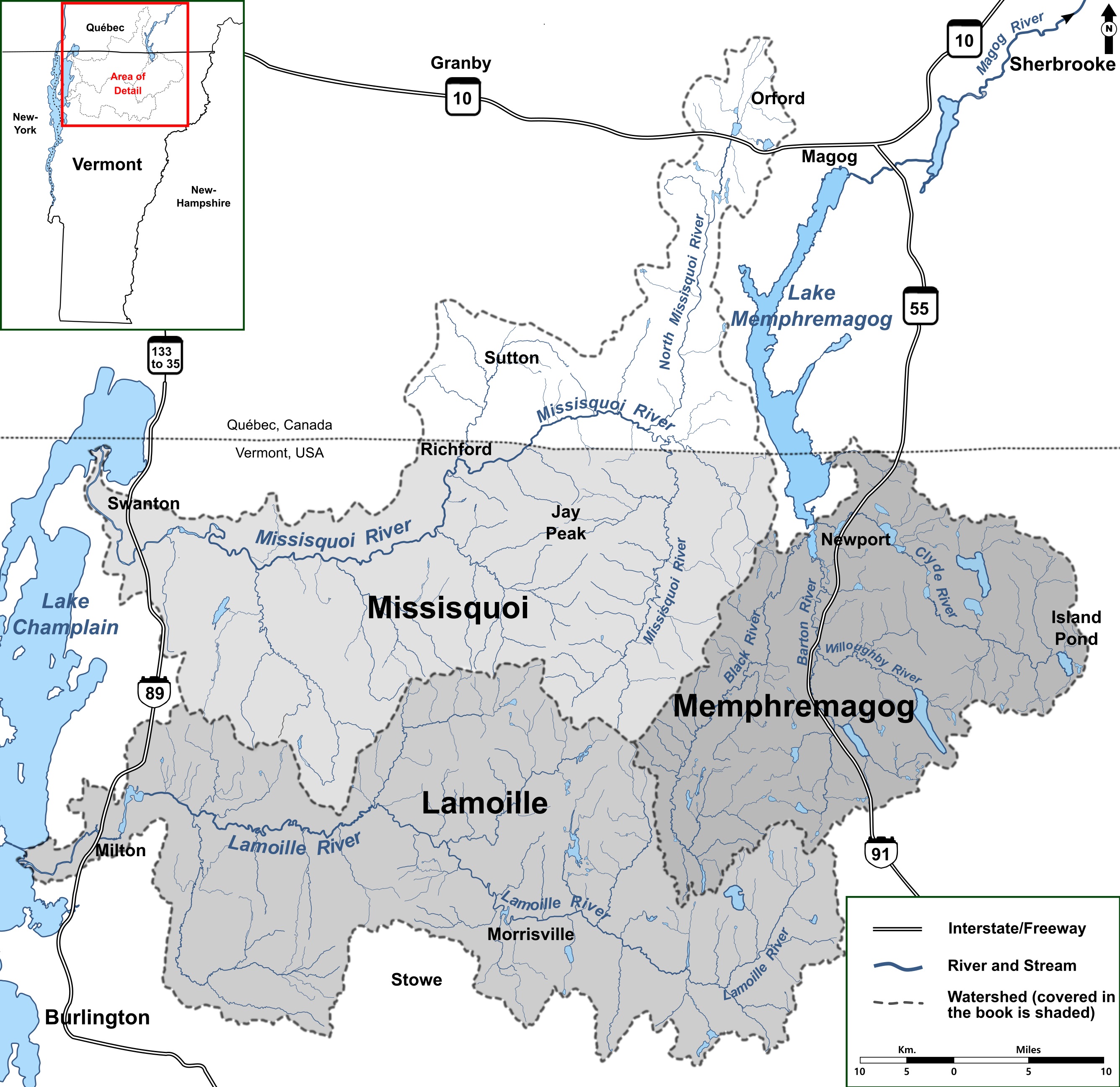
Le nord du Vermont et les trois bassins versants couverts dans le livre.
-
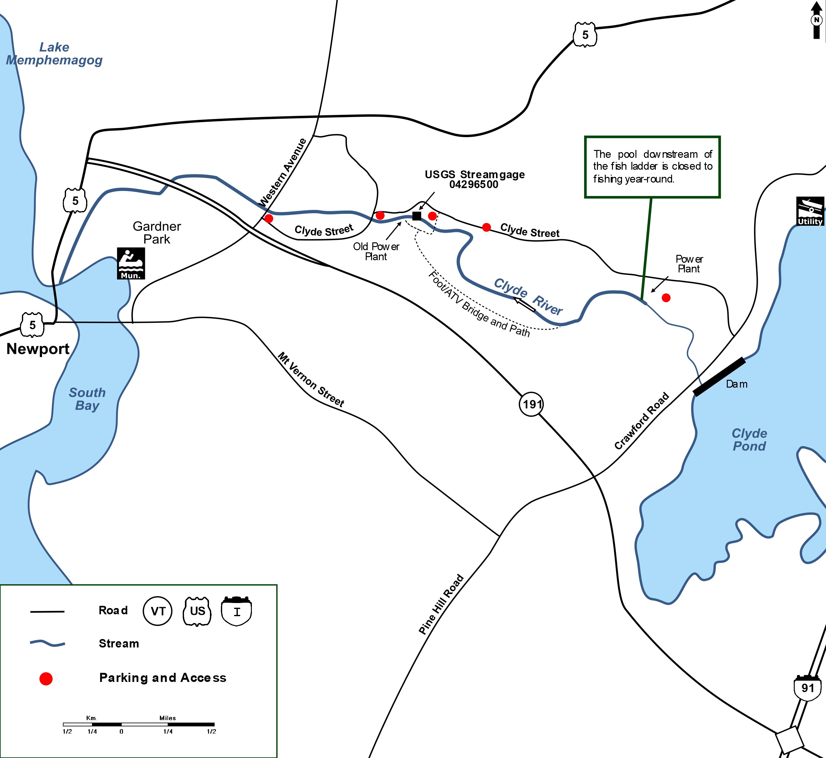
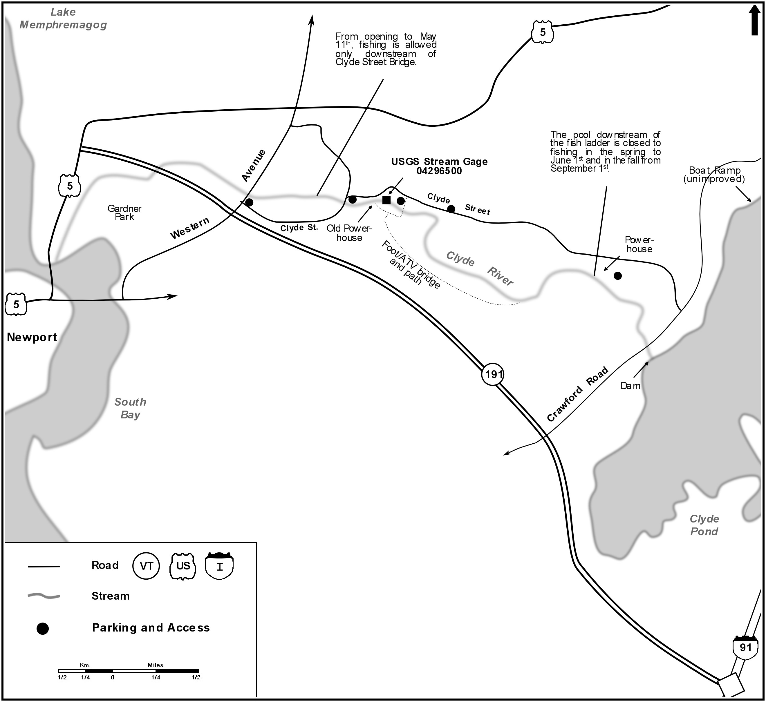
Exemple d’une carte détaillée : la rivière Clyde à Newport est renommée pour la pêche au saumon.